

Every successful project starts with understanding the site.
Whether you’re designing a commercial building, extending an existing facility or planning new infrastructure, the surrounding environment influences every design decision. Building heights, neighbouring properties, terrain, access routes and existing conditions all play a part in shaping a successful proposal.
Historically, creating accurate site context in SketchUp often meant sourcing mapping data from multiple places, modelling neighbouring buildings manually or relying on third-party extensions. While effective, these approaches could slow down the early stages of design when rapid iteration is most important.
SketchUp’s enhanced Add Location tools make it easier to bring real-world context directly into your model. With access to native 3D buildings, terrain and aerial imagery, you can quickly create realistic site models and spend more time exploring design options instead of building the surrounding environment from scratch.
Early design decisions have a lasting impact on the success of a project.
Working without site context can make it difficult to judge scale, understand relationships with neighbouring buildings or identify potential planning challenges. By introducing accurate surroundings from the outset, architects and design teams can evaluate proposals within the environment they’ll ultimately occupy.
This provides greater confidence during concept design, supports more informed discussions with clients and planning authorities, and helps identify issues before they become costly changes later in the project.
One of the biggest improvements to SketchUp’s Add Location workflow is the ability to import native 3D buildings directly into your project.
Instead of spending valuable time recreating surrounding properties, you can instantly populate your model with existing buildings to provide realistic urban context. Available across SketchUp for Desktop, Web and iPad, this feature helps you visualise how your proposal fits within its surroundings from the very beginning.
Whether you’re assessing building massing, reviewing sightlines, checking overshadowing or understanding how a design complements the existing streetscape, having accurate context available immediately leads to faster and more informed design decisions.
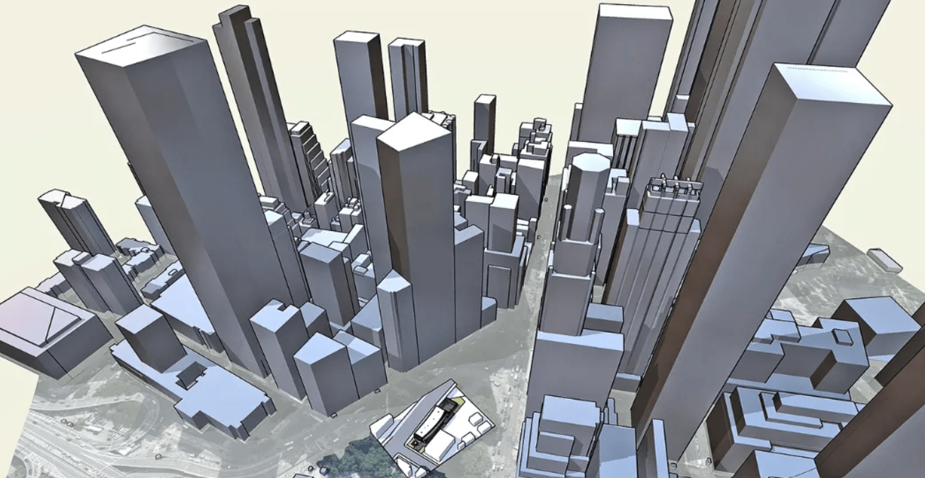
No two projects require the same level of detail. SketchUp’s updated terrain import tools give you greater control by allowing you to adjust terrain mesh density during import. Lower-resolution terrain keeps conceptual models lightweight and responsive, while higher-density meshes provide additional accuracy where detailed topography is required.
This flexibility allows you to balance model performance with the level of detail your project demands, making it easier to adapt your workflow as designs develop.
For refurbishment, retrofit and infrastructure projects, understanding existing conditions is just as important as designing what’s new.
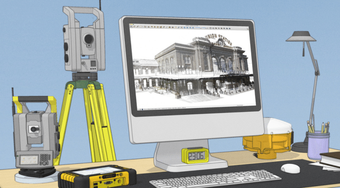
SketchUp Studio users can extend their workflow using Scan Essentials, which continues to evolve with improvements that simplify working with point cloud data. Enhanced surface mesh generation and improved visualisation make it easier to transform survey information into usable geometry.
By combining point cloud data with imported terrain and surrounding buildings, you can create a far more accurate representation of existing conditions, giving your project team greater confidence throughout the design process.
The biggest advantage of working with accurate site context isn’t simply producing more realistic models, it’s making better design decisions sooner.
With surrounding buildings, terrain and existing conditions already in place, designers can spend less time recreating context and more time exploring ideas. Alternative layouts, building heights, access routes and massing options can all be tested quickly within a realistic environment, helping teams identify the strongest solution before progressing into detailed design.
Early design confidence often leads to smoother project delivery, fewer revisions and more productive conversations throughout the design process.
Communicating a design is much easier when people can see it in context.
Presenting proposals alongside neighbouring buildings and real-world surroundings gives clients, planners and project stakeholders a much clearer understanding of the outcome than standalone models or 2D drawings alone.
Combined with SketchUp’s collaboration tools, including browser-based model viewing, commenting and shared feedback, project teams can review proposals together, gather input and refine designs more efficiently. The result is a more collaborative workflow that helps build confidence and supports faster decision-making.
To maximise the benefits of contextual modelling, it’s worth establishing a consistent workflow from the start of every project.
Import site context early to provide a solid foundation for concept design, use native 3D buildings to evaluate scale and urban relationships, and adjust terrain resolution to balance performance with accuracy. Where survey data is available, combine imported context with Scan Essentials to create an even more complete representation of existing conditions.
Keeping contextual information organised with Tags also makes it easier to manage visibility as projects develop, while sharing contextual models with clients early encourages more informed feedback before designs become fixed.
Good design is about more than the building itself; it’s about how that building responds to its surroundings.
SketchUp’s enhanced Add Location tools, native 3D buildings and continued improvements to Scan Essentials make it easier than ever to create accurate site context from the earliest stages of a project. The result is faster concept development, more informed design decisions and stronger collaboration throughout the project lifecycle.
Whether you’re using SketchUp for architecture, engineering or construction projects, TMS CADCentre can help you get more from your software. From choosing the right SketchUp subscription to supporting your wider design workflow, our team is here to help you maximise your investment.